Da ich Karten und GPS Daten sehr interessant finde, bastle ich gerne Karten und füge sie z.B. hier auf meinen Blog ein. Prinzipiell fallen mir 3 Möglichkeiten ein, Karten in Blog Posts einzubinden. Zu jeder dieser 3 Arten stelle ich euch ein konkretes Beispiel vor und erkläre euch die Vor- und Nachteile. Externe Karten einbinden: … Continue reading Karten in Blog Posts einfügen
Tag: gps
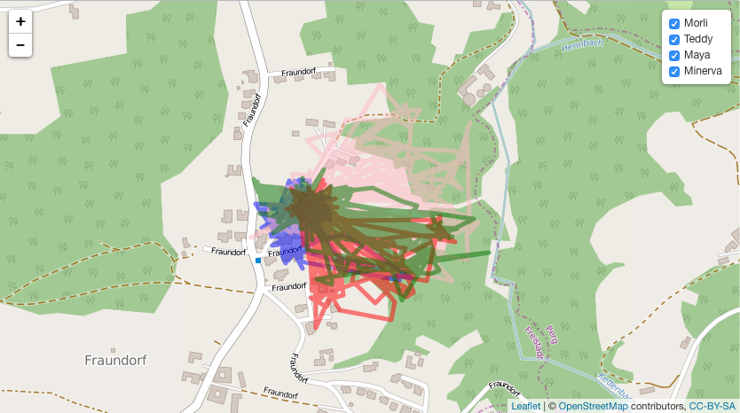
Cat tracking data collected with my Tractive GPS Pet Tracker
For about one year I have used the Tractive Pet Tracker to track my families (and my) cats, my grandmothers cats and our road trip to Sweden (German). Now I want to share that cat tracking data and some additional data with you. In this post I will Share the raw data with you Filter … Continue reading Cat tracking data collected with my Tractive GPS Pet Tracker
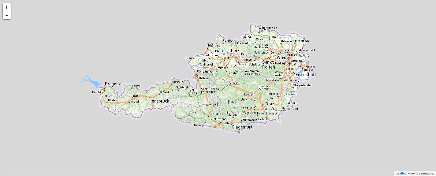
Adding basemap.at tiles to an R leaflet plot
Recently I wanted to visualise some data in a map of Austria. R Leaflet provides a pretty good looking map by default (openstreetmap.org) but I wanted to use basemap.at, which is a map for Austria and therefore probably the most accurate map available for Austria. Actually it is not very difficult but it was the … Continue reading Adding basemap.at tiles to an R leaflet plot
Tractive GPS & Tractive Dog Walk
In one of my first posts in this blog I wrote a review about my Tractive GPS Pet Tracker. I have also commented on the app Pet Manager LITE/PRO which was their app for both tracking your pets (useful for cats and dogs) and recording your walks (mostly useful for dogs). Since then they have … Continue reading Tractive GPS & Tractive Dog Walk
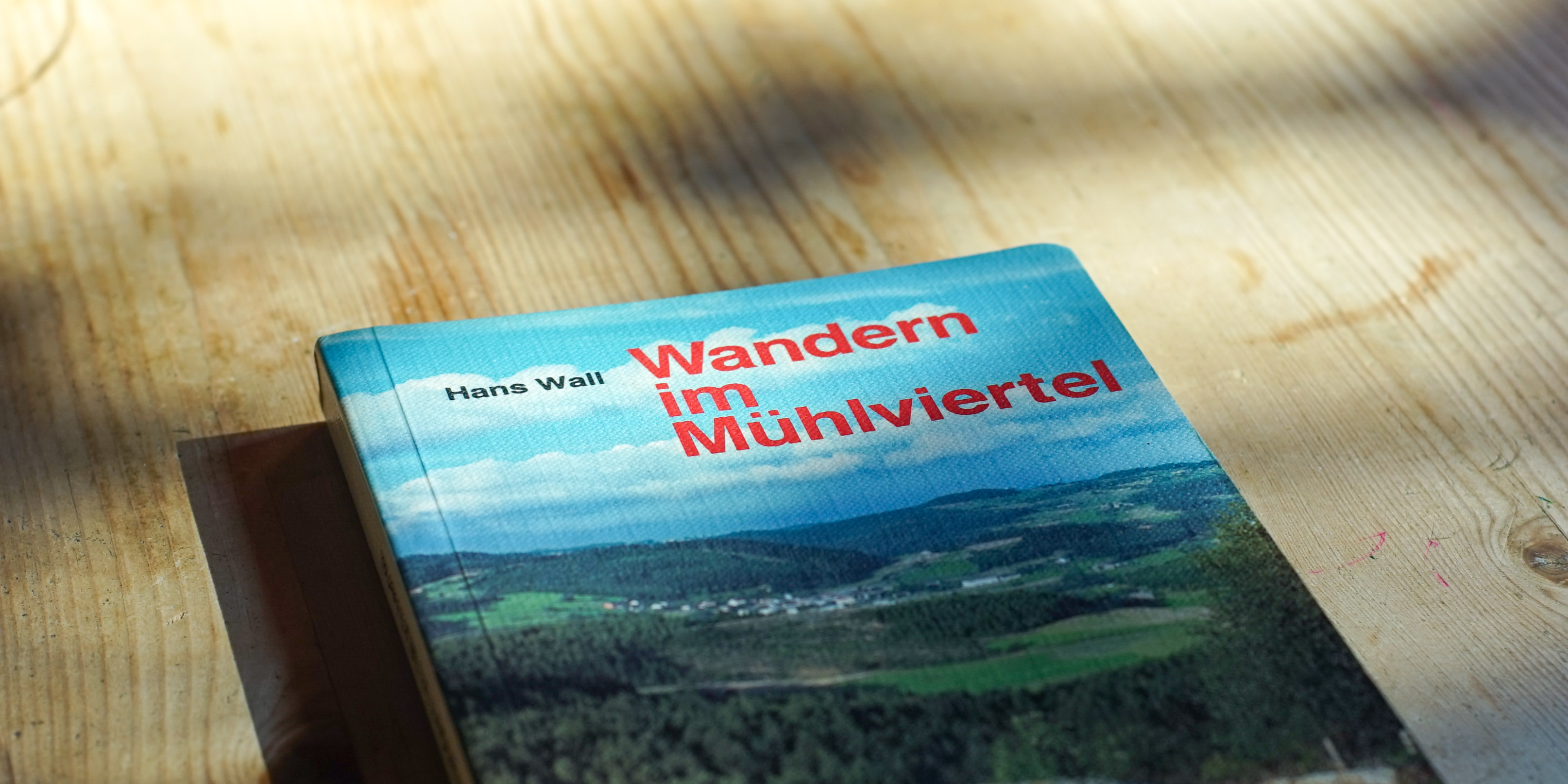
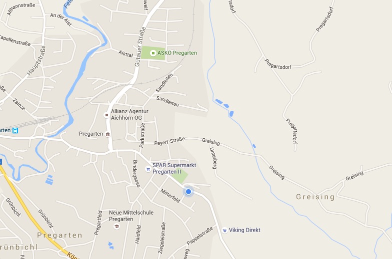
Wanderung Tragwein-Reichenstein-Pregarten
Im Vorfeld unserer Wanderung haben wir uns mit Hilfe von Wanderkarten, einem alten Wanderbuch von meinem Papa, google maps und bergfex.at eine Route festgelegt. Ein Grund für unsere Wanderung war, dass wir das Equipment (Rucksäcke, Zelt, Matte, Schlafsack, …) für unseren geplanten Campingurlaub in Schweden testen wollten. Deswegen haben wir nicht nur das nötigste (Getränke, … Continue reading Wanderung Tragwein-Reichenstein-Pregarten
First steps in QGIS (including installation on OS X)
Last week I visited a geo data talk at Linuxwochen Linz which was mainly about the tool QGIS. The talk was held by two guys who also write this blog. I am planning to work more with geo data in the future so I installed QGIS and tried a simple example. Installation on OS X … Continue reading First steps in QGIS (including installation on OS X)

Basic handling of spatial data (like GPS coordinates)
This week I am going to show you some very basic things you can do with GPS coordinates. In this post you will learn how to: Read gpx files Read files containing plain text coordinates (like N 48 12.123 and N 48 12′ 123″) Parse characters string that contain unformatted coordinates (like above) Convert minute … Continue reading Basic handling of spatial data (like GPS coordinates)